Frühere Suchanfragen
Suchoptionen
Verwaltet von:

#LIDAR


 Greg Cocks
 RiverREM - Generating River Relative Elevation Model (REM) Visualisations
--
https://github.com/OpenTopography/RiverREM <-- shared GitHub repository
--
https://opentopography.github.io/RiverREM/ <-- shared documentation
--
https://opentopography.org/blog/new-package-automates-river-relative-elevation-model-rem-generation <-- shared Open Topography blog post about RiverREM
--
H/T Heidi Luchsinger / Open Topography
[this post should not be considered as an endorsement of this product aka caveat emptor]
#GIS #spatial #mapping #remotesensing #earthobservation #Python #LiDAR #RiverREM #visualisation #hydrology #water #river #rivervalley #floodplain #terraces #GitHub #opensource #opendata #DEM #REM #model #modeling #RiverRelativeModel #documentation #tutorial #learning #tool #elevation #raster #sinuosity #drainage


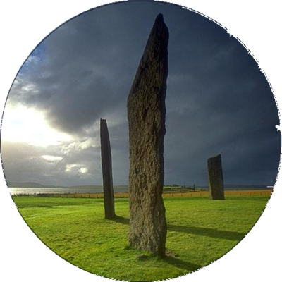
stone circles : cost-effective photogrammetry techniques for surveying, recording, documenting [pdf 25pp] #StoneCircle #photogrammetry #KiriEngine #lidar https://arrow.tudublin.ie/cgi/viewcontent.cgi?article=1230&context=level3


AI aids large-scale mapping of Angkorian reservoirs beyond Greater Angkor
A group of international researchers has harnessed the strength of artificial intelligence to reveal previously unknown reservoirs from the Angkorian period in Cambodia...
More information: https://archaeologymag.com/2025/04/ai-aids-mapping-of-angkorian-reservoirs/
Follow @archaeology


Schade #heise. Wieder mal ein Downer für mich: Ein für mich prinzipiell sehr interessanter Artikel zu Rasenrobotern, der mit keinem Wort erwähnt, ob man eines der Geräte auch ohne Verbindung zum Hersteller voll nutzen kann.
Starke Abhängigkeit zu einer App lässt mich vermuten, dass damit auch die #Cloud mitgemeint ist.
Dann hoffe ich, dass mein alter #Gardena möglichst lange noch durchhält. Der braucht weder Internet noch Cloud noch App für seine Funktion.
"Top 10: Der beste #Mähroboter ohne #Begrenzungskabel mit #Kamera, #GPS oder #Lidar"
https://www.heise.de/bestenlisten/testsieger/top-10-der-beste-maehroboter-ohne-begrenzungskabel-mit-kamera-gps-oder-lidar/gb7xhbg
Nebenbei: der flexible Begrenzungsdraht scheint mir immer noch deutlich praktischer zu sein als die teuren High-Tech-Alternativen: einfach zu installieren, einfach zu korrigieren/finetunen, lästig aber akzeptabel bei der Fehlersuche bei Kabelbruch.
YMMV.


#LiDAR (1 m resolution) of the Atchafalaya Basin within the Centerville NW, LA, NE DOQQ showing Grand Lake & Big Bayou Pigeon in Iberia & St. Martin Parishes. There are 7 recorded archaeological sites in this view. #Archaeology


#LiDAR of the southwest 1/4 of the Boneset Creek, LA, quadrangle map I processed at 0.25 m resolution: Top) elevation range in blue-green-brown-red; Middle) expanded color palette; Bottom) overhead 3D rendering. #Maps #Archaeology


#Swisstopo hat seit 2017 das gesamte Land mit #Lidar kartiert. Diese Erfassung ist nun abgeschlossen, und über die Swisstopo-Website können die Datensätze kostenfrei heruntergeladen werden.
Was besonders auch die #Archäologie freut.
SWI swissinfo.ch: Feine Gelände-Scans machen die #Schweiz zur Fundgrube der Archäologie


https://www.europesays.com/1969321/ Researchers develop fast, eye-safe LIDAR using next-gen quantum dots #Data #Lidar #LidarSensors #MaterialScience #QuantumDots


Last week I gave a presentation about "Airborne Laser Scanning Data in Germany - Availability, Challenges and Potentials" at #fossgis conference in Münster.
Video recording: https://media.ccc.de/v/fossgis2025-58287-airborne-laserscanning-in-deutschland-verfugbarkeiten-herausforderungen-potenziale
Presentation slides: https://wiesehahn.github.io/presentation-fossgis25

Kinematic Evolution Of A Large Paraglacial Landslide In The Barry Arm Fjord Of Alaska
--
https://doi.org/10.1029/2023JF007119 <-- shared paper
--
https://doi.org/10.5066/P9EUCGJQ <-- shared technical article
--
https://www.sciencebase.gov/catalogMaps/mapping/ows/5fff561ed34e592d8671ee85?service=wms&request=getcapabilities&version=1.3.0 <-- shared web mapping service
--
#GIS #spatial #mapping #massmovement #landslide #engineeringgeology #remotesensing #sitespecific #LiDAR #iFSAR #paraglacial #kinematics #mapping #monitoring #spatialanalysis #spatiotemporal #fedscience #risk #hazard #glacier #retreat #climatechange #Alaska #BarryArm #fjord #hazardassessment #tsunami #wave #BarryGlacier #change #sensors #fieldwork #surveillance #melting #permafrost #Whittier #geophysics #geology #Alaska #geomorphometry #deglaciating
@USGS


https://www.europesays.com/1957918/ Phlux Technology bags over €10 million for their infrared sensor technology #america #BenWhite #BGF #CheeHingTan #FibreBroadband #foresight #InfraredSensor #JoShienNg #Lidar #NorthernGritstone #OctopusVentures #OpticalCommunications #PhluxTechnology #science #SeriesA #SHEFFIELD #technology #UnitedStates #UnitedStatesOfAmerica #UniversityOfSheffield #US #USA


Urban settlements in the #Amazon region? They existed long before Columbus. But knowledge about them was more or less lost for a long time. In her keynote lecture on Tuesday, Bolivian archaeologist Carla Jaimes Betancourt from the #UniBonn explained why #Lidar technology is now bringing back this knowledge and what new discoveries have already been made.
In an interview, she also told us why she became an archaeologist 
#KielScales25 #Urbanism #Bolivia #Archaeology #LlanosdeMoxos #landscapeengineering #landscapearchaeology #keynote

People keep putting fake walls in front of Teslas
In the tesla fanboy's video, the Tesla Model Y with confirmed FSD (in this case, version 12.5.4.2) didn’t fare better than Rober’s — he had to manually stop the vehicle before it crashed into the fake wall that, to my human eyes, doesn’t look quite as convincing.
#MarkRober #lidar #LooneyTunes #WileECoyote #tesla #ADAS #automotive #auto #cars #transportation #safety
https://www.theverge.com/news/634130/tesla-fsd-wile-e-coyote-youtube-test-cybertruck


Someone is LIDAR scanning my town, so I went and set up a giant question mark made out of 5 gallon buckets on my hill 

Tesla fans expose Tesla’s own shadiness in attempt to defend Autopilot crash
A group of #Tesla fans inadvertently exposed Tesla’s shadiness regarding crashes involving Autopilot by attempting to claim the ADAS was not active in a crash test
It was not only active, but it also disengaged itself less than a second before the crash—a known shady behavior of Tesla’s Autopilot
#MarkRober #lidar #LooneyTunes #WileECoyote #ADAS #automotive #auto #cars #transportation #safety
https://electrek.co/2025/03/17/tesla-fans-exposes-shadiness-defend-autopilot-crash/
#TagderRaumfahrt – auch in #Leipzig!
Am Tag der Raumfahrt öffnen am 28. und 29. März 2025 viele Einrichtungen in Deutschland ihre Tore oder starten Aktionen zum Mitmachen. Mit dabei auch @tropos_de im #Wissenschaftspark Leipzig in der Permoser Straße 15 am Freitag, den 28.03.25 17:00-19:00. Wir zeigen wie #Laser die #Wetter- und #Klima-Beobachtungen revolutionieren. Die #Lidar-Technik hat neue Einblicke in die Wolken möglich gemacht:
https://www.tropos.de/aktuelles/pressemitteilungen/details/erster-tag-der-raumfahrt-auch-in-leipzig
LiDAR For Rapid Geomorphological Assessment In Relict Periglacial Landsystems
--
https://doi.org/10.1144/egsp30-2024-46 <-- shared paper
--
#GIS #spatial #mapping #remotesensing #earthobservation #LiDAR #A21 #transportation #motorway #UK #England #Kent #geology #engineeringgeology #earthworks #massmovement #risk #hazard #slope #failure #construction #groundworks #excavation #forensic #periglacial #landforms #glacial #deposition #landsystem #geohazards #geomorphology #model #spatialanalysis #casestudy


